|
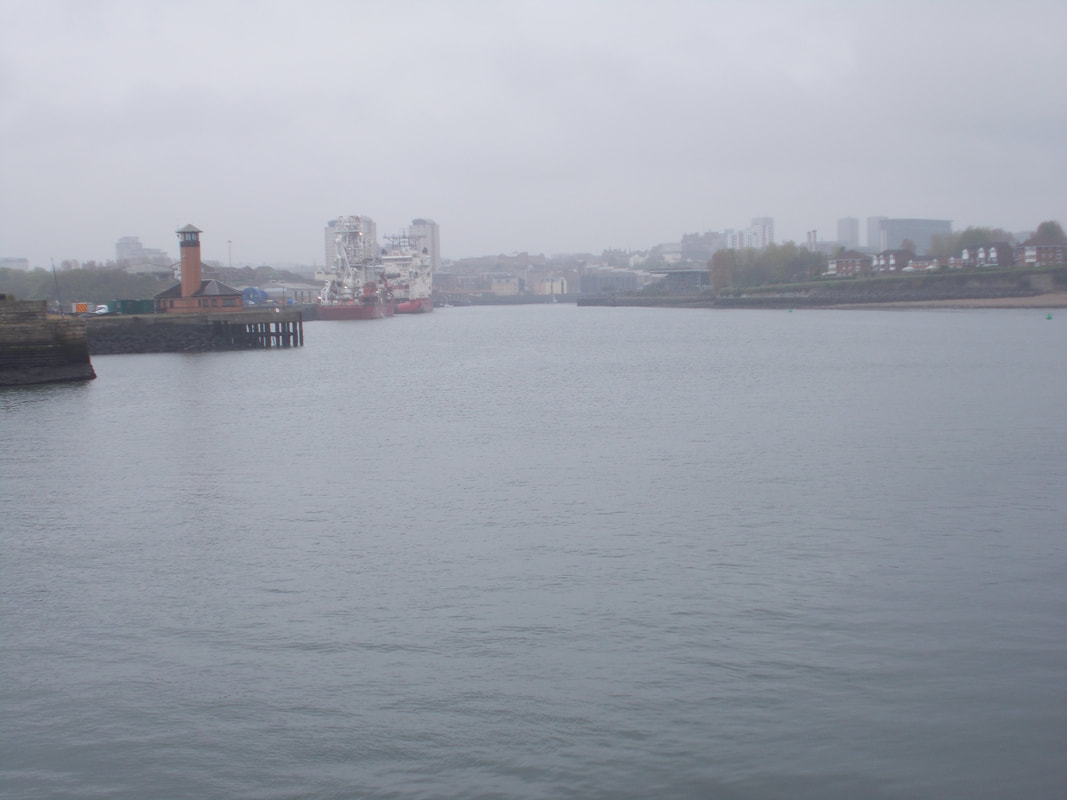
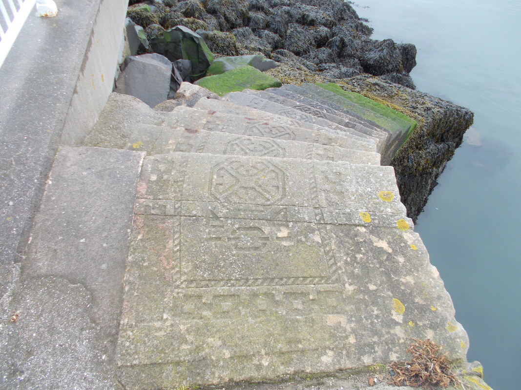
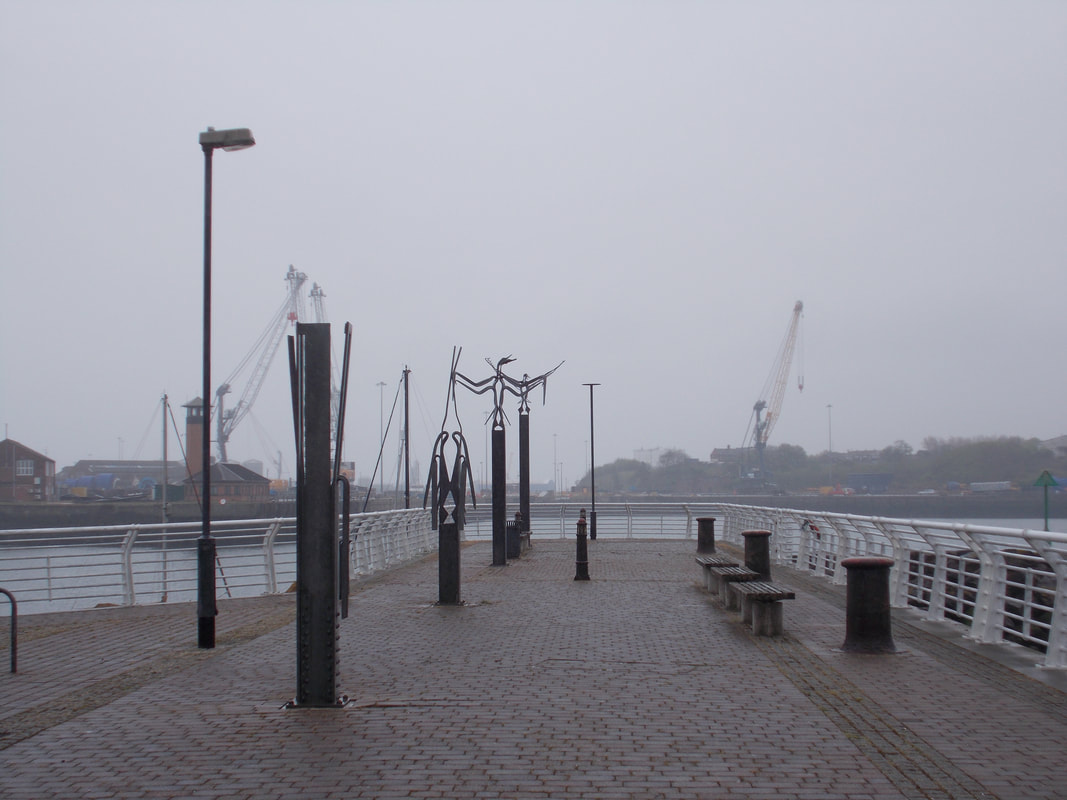
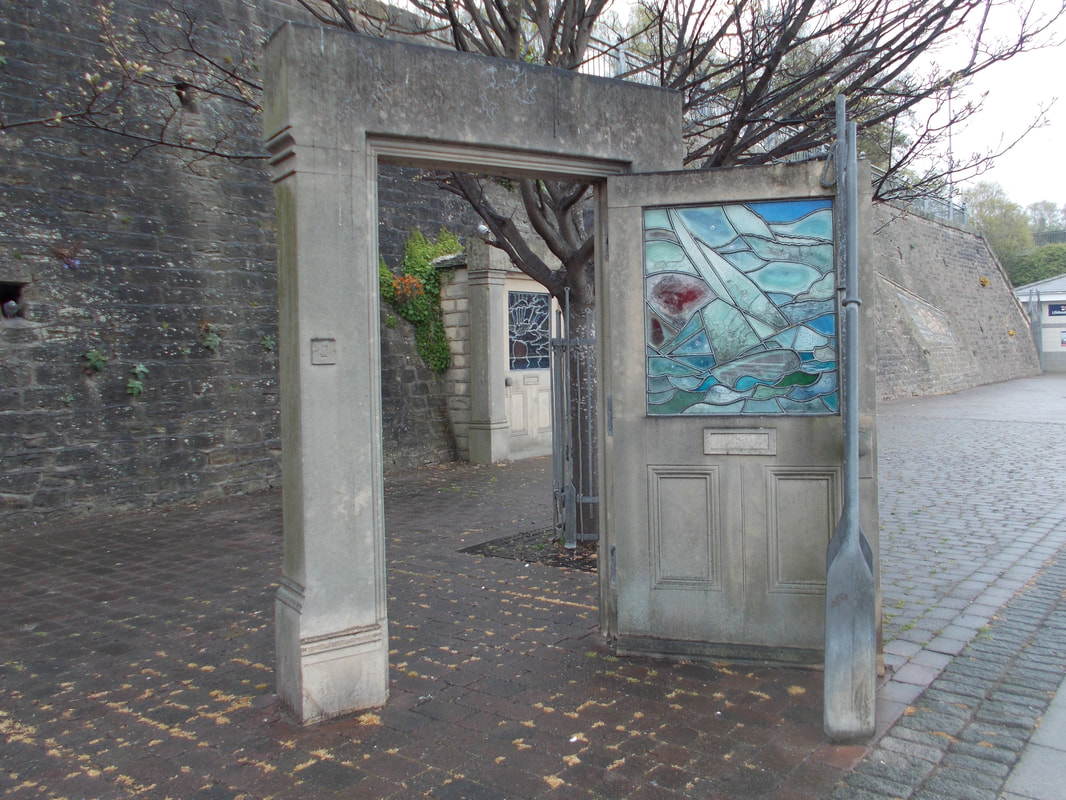
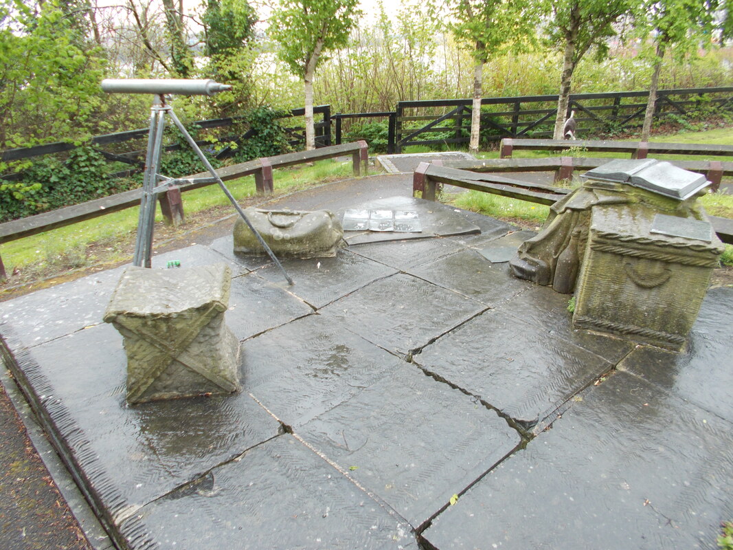
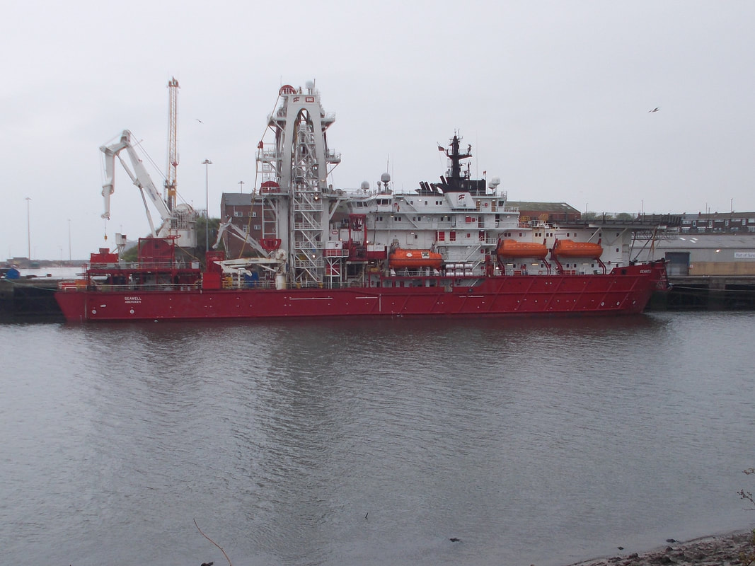
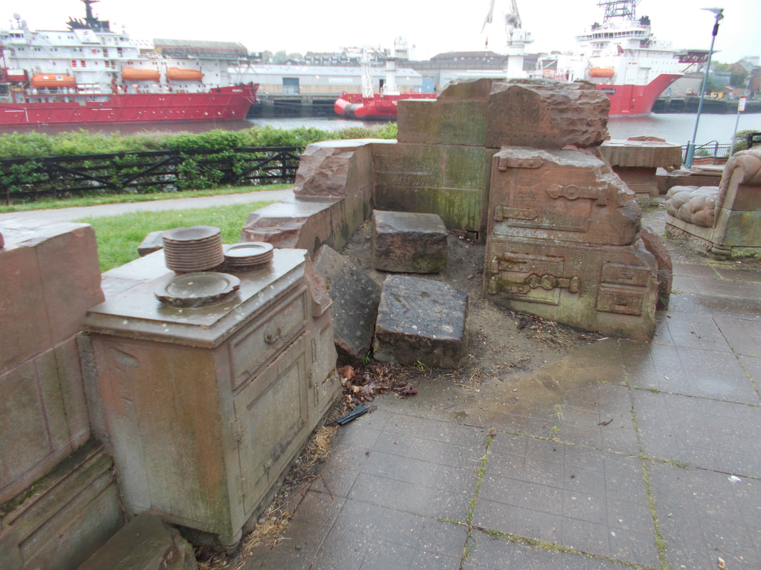
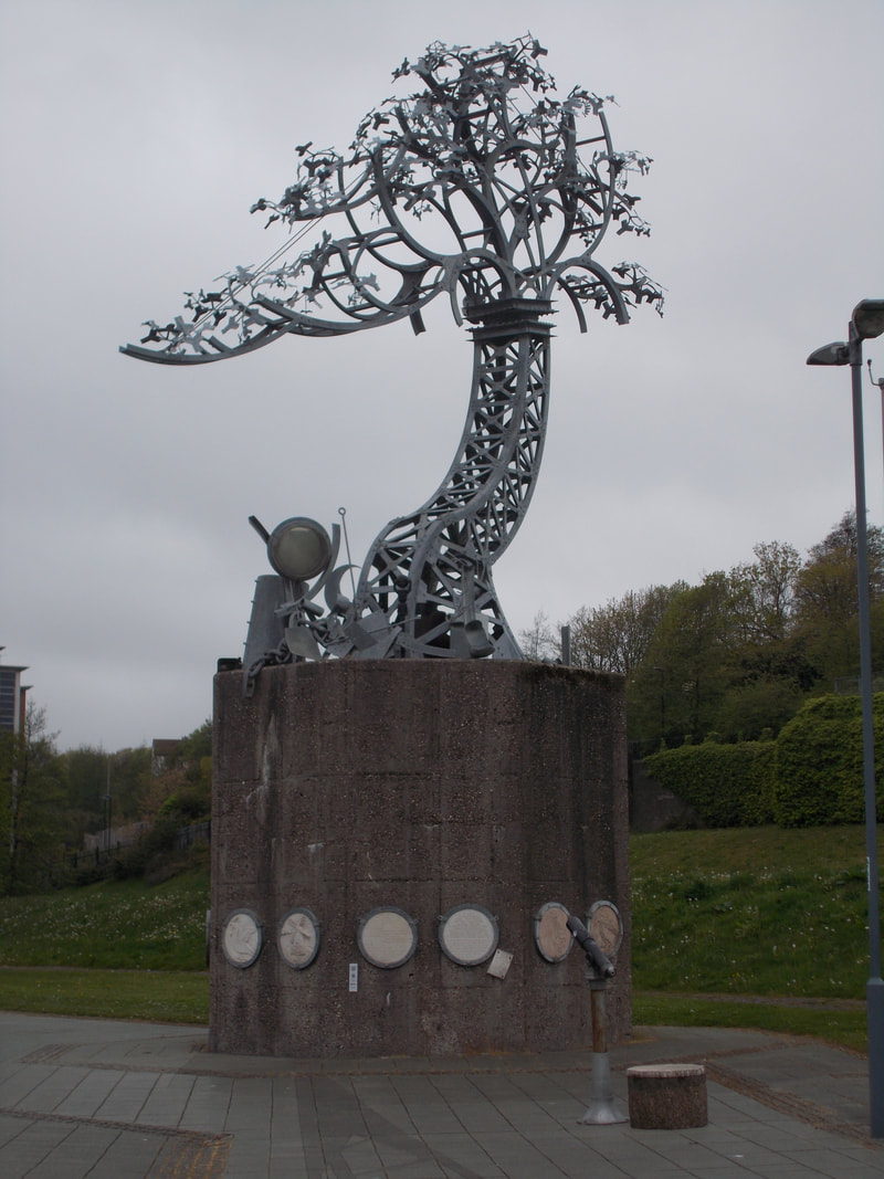
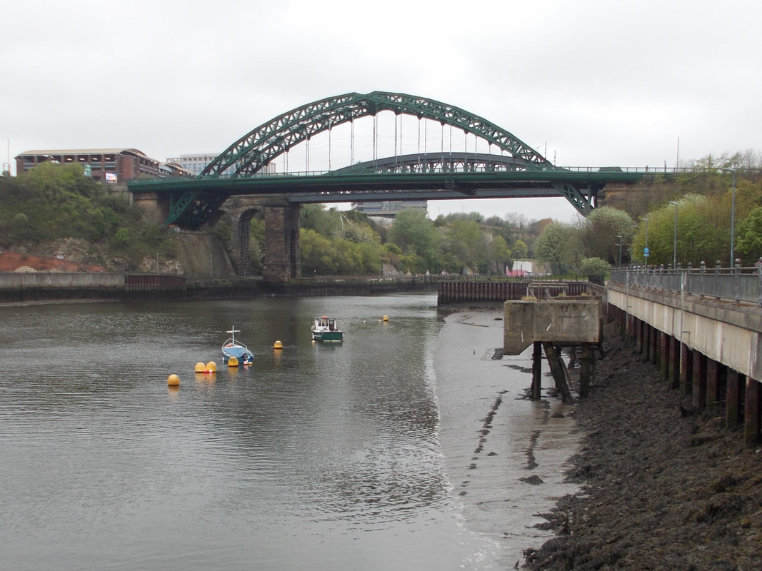
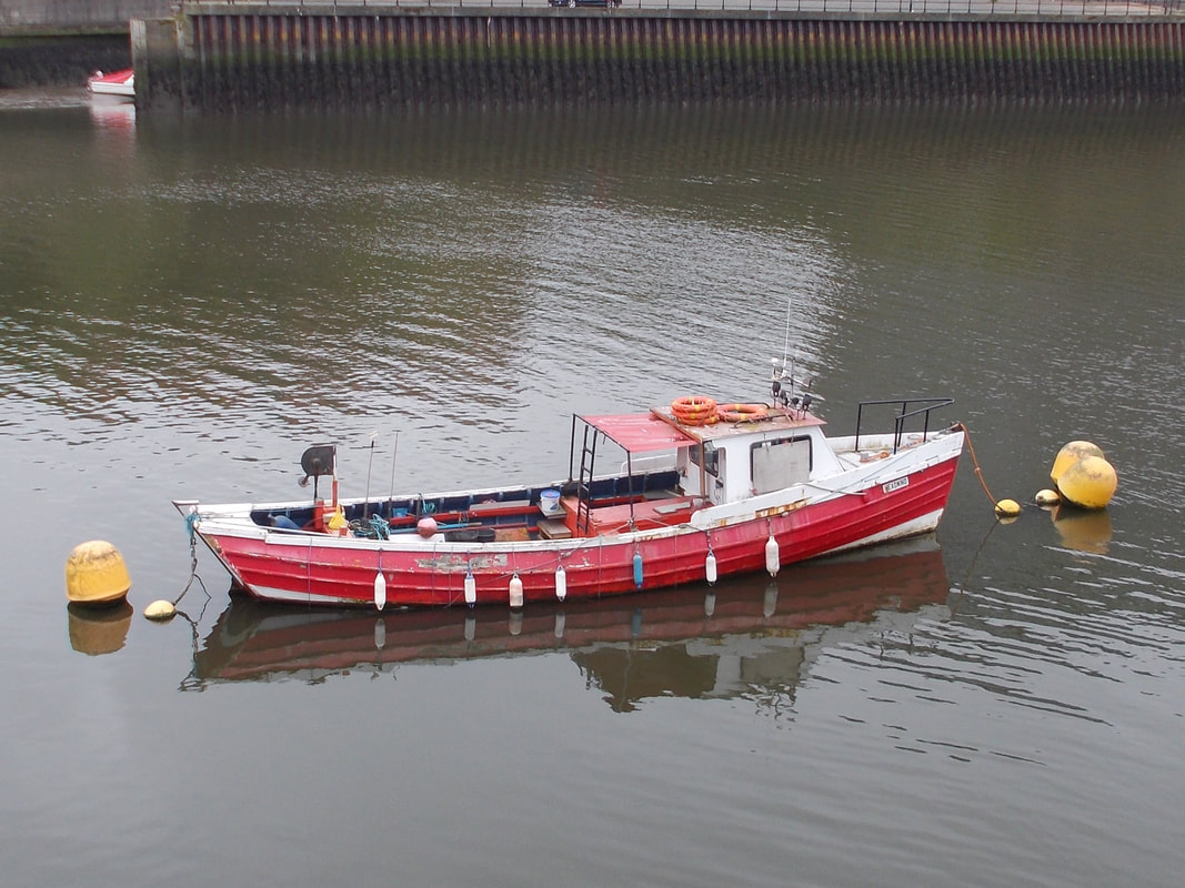
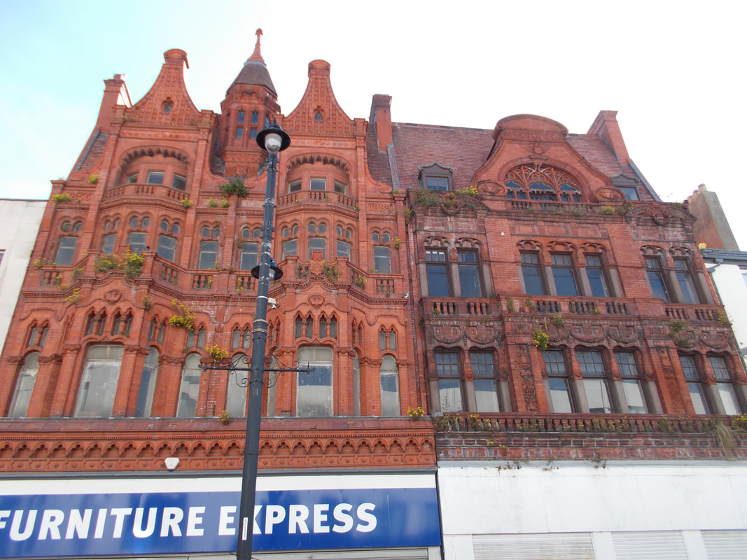
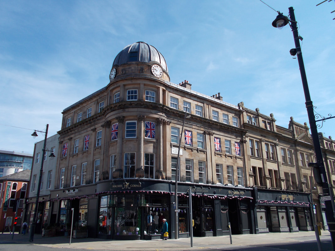
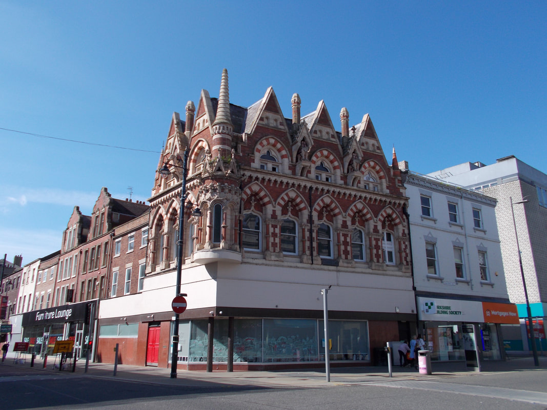
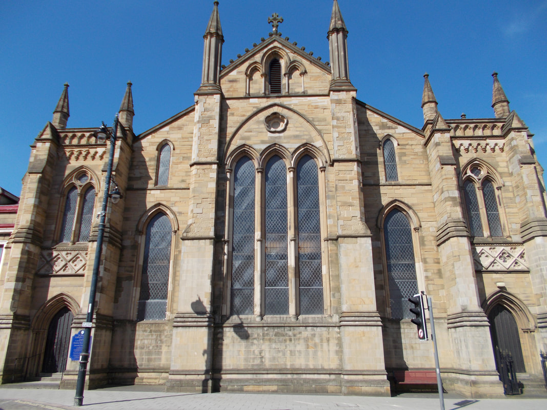
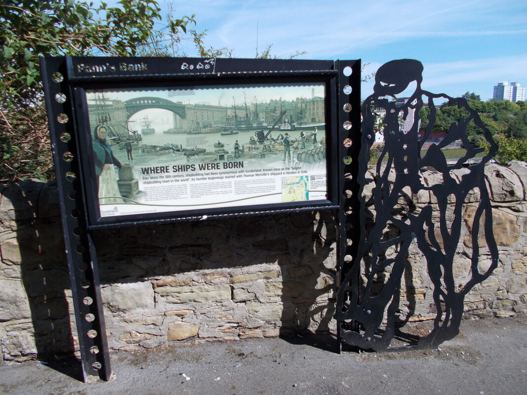
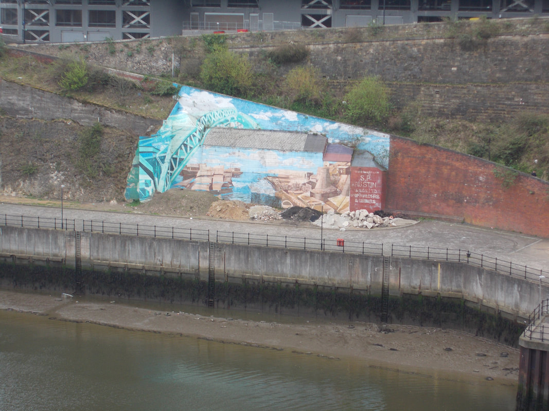
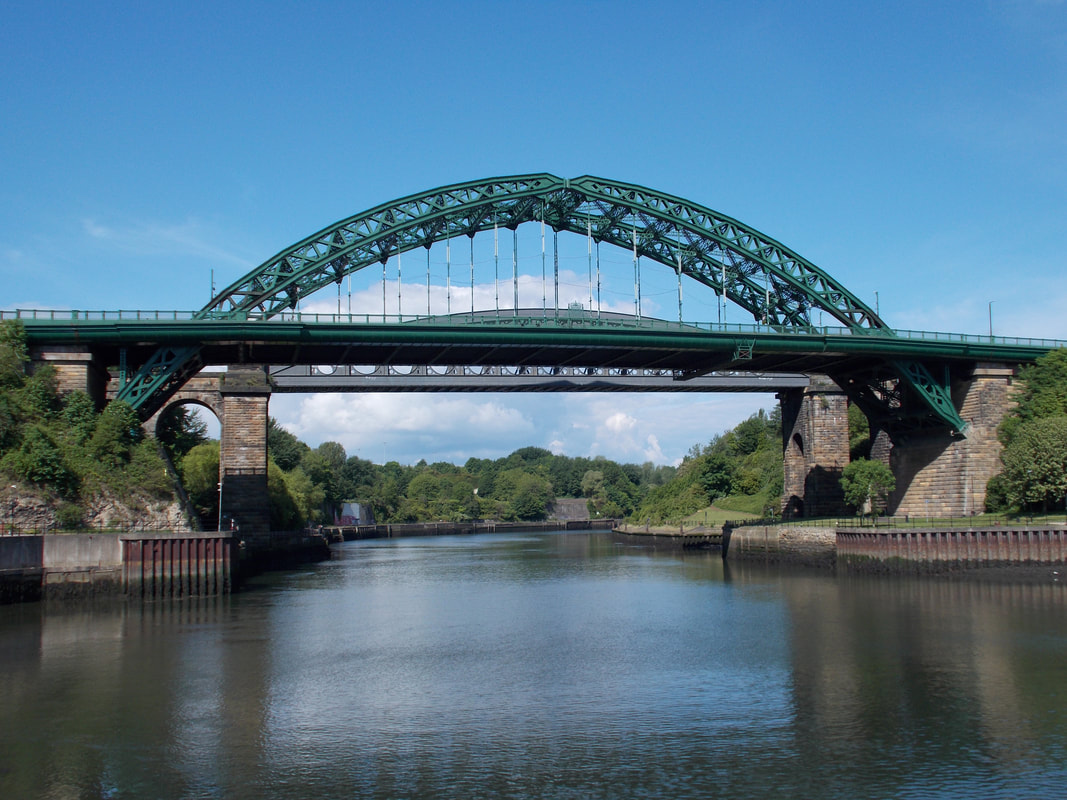
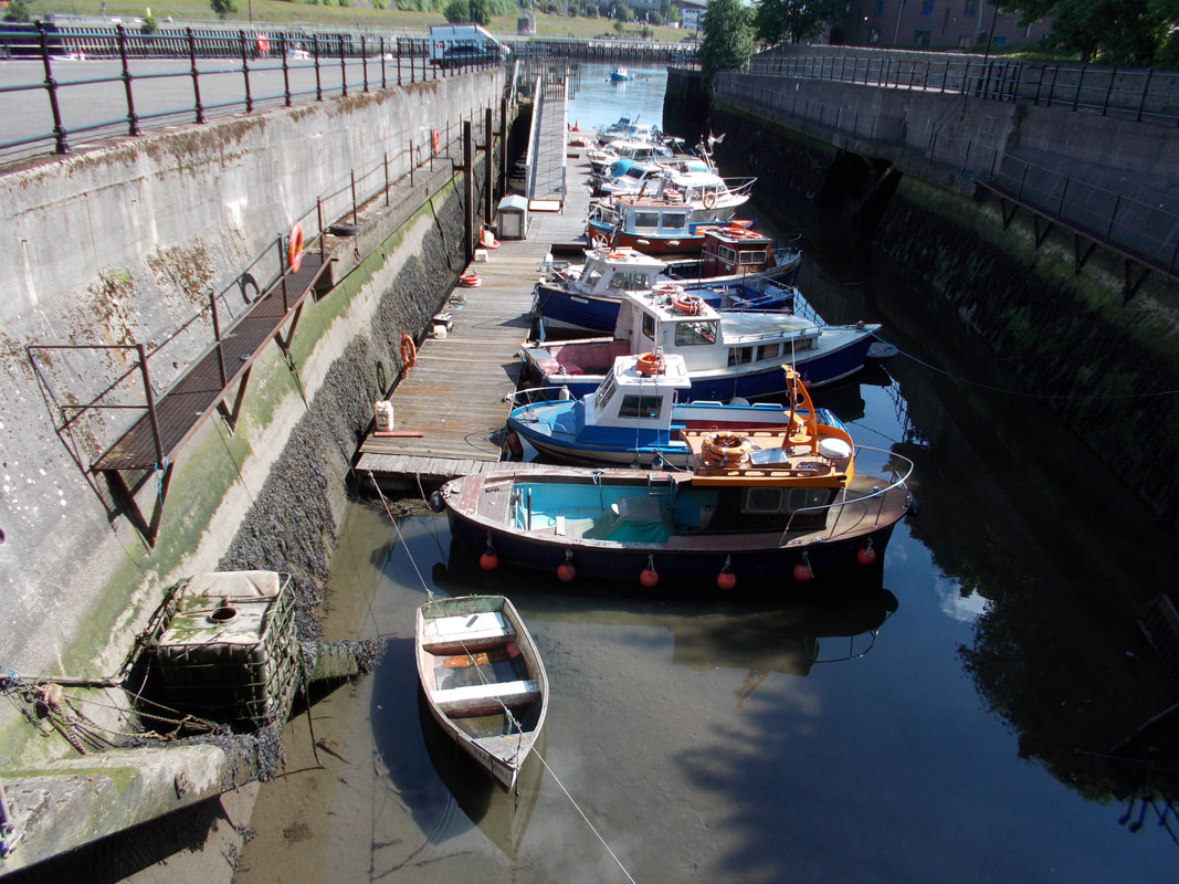
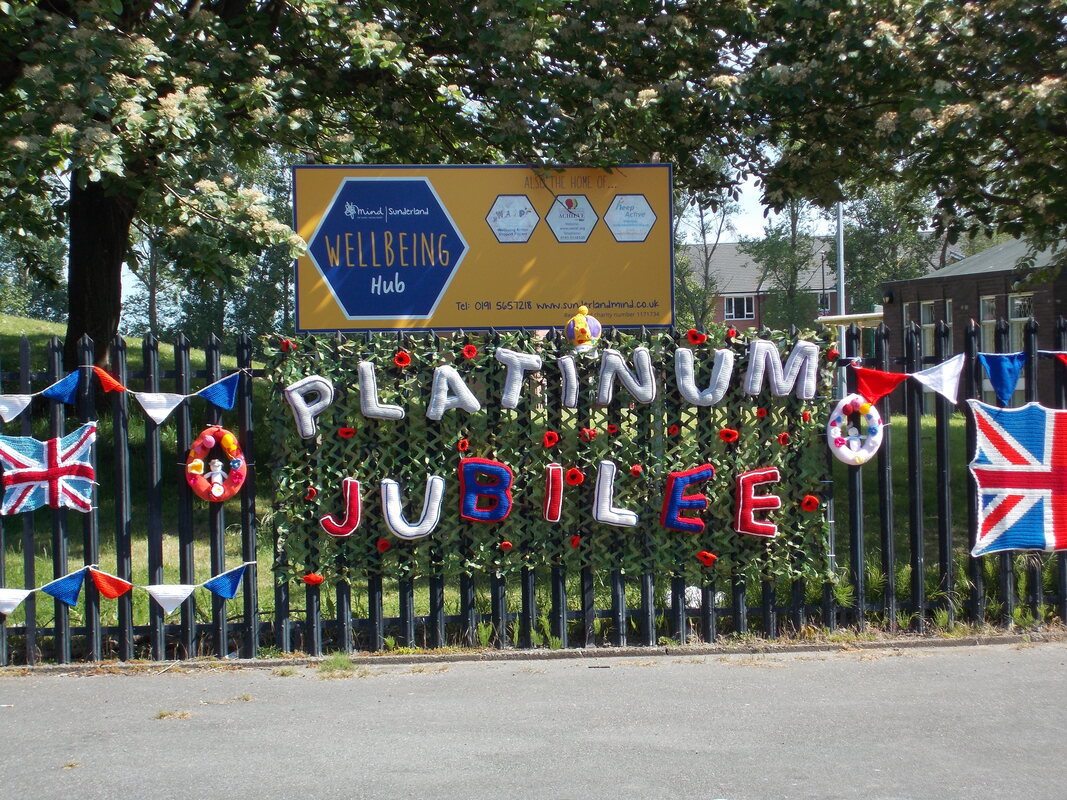
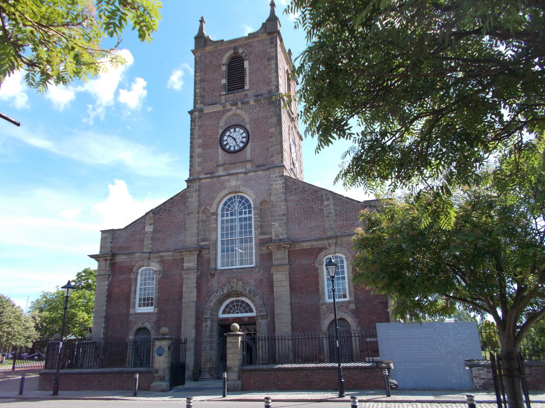
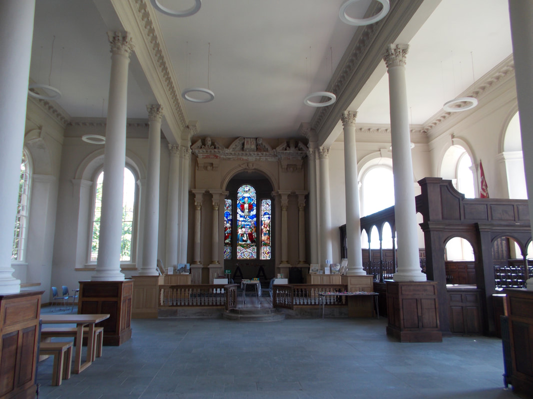
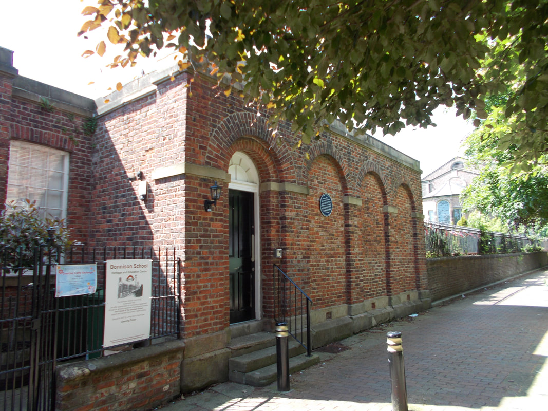
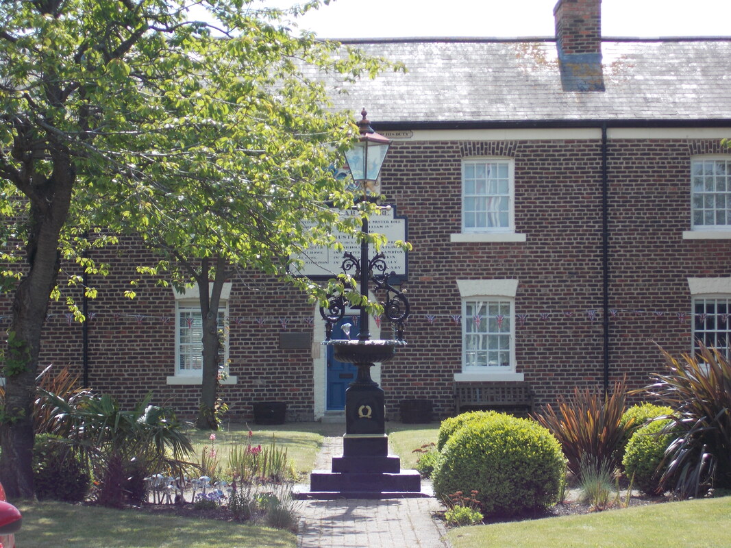
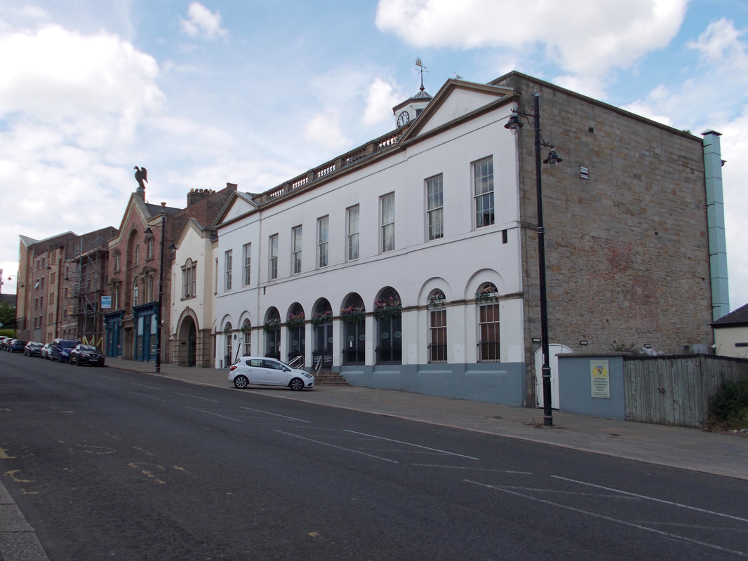
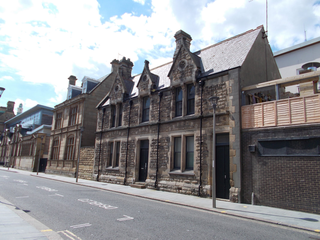
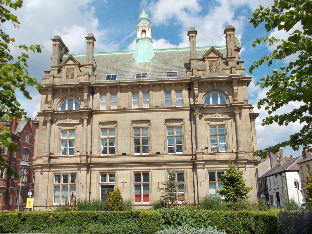
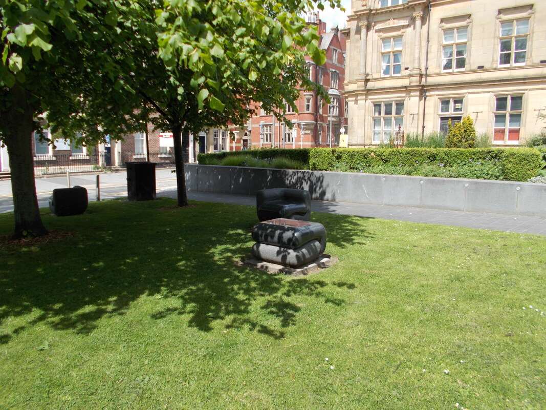
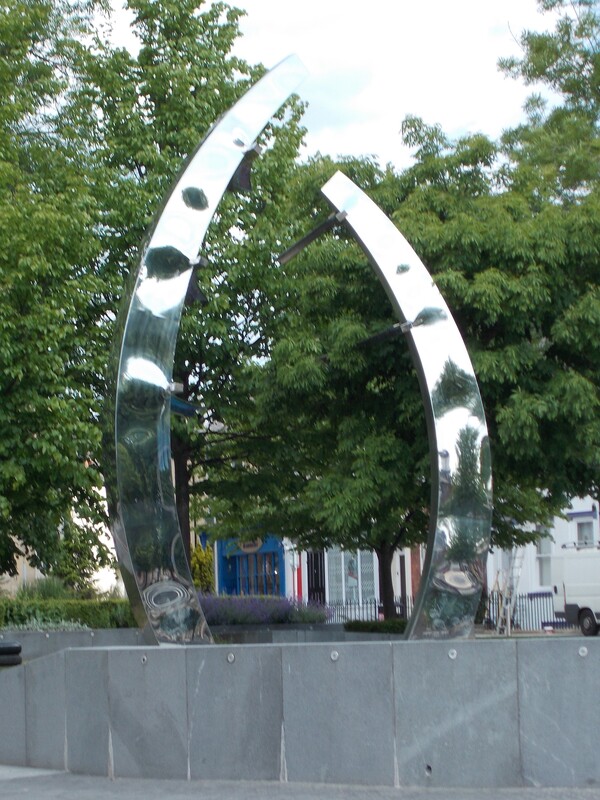
Introduction You will note that there has been a long gap between walk 2 and 3. Illness, work commitments and a trip to Scotland has kept me from the challenge. Even this short stretch of the England Coast Path proved to be a challenge and I completed it in 2 stages on 2nd May and the 2nd June, both bank holidays. Roker to the Wearmouth Bridge (2nd May) When I left home, the weather was fine, by the time I had arrived in Sunderland the rain had started. I parked the car in the town centre and then went to the bus stop only to find the bus stop had changed from the published schedule. As I reached the new bus stop I was quite shocked to see the E1 come around the corner in its open-topped glory! Clearly no-one wanted to sit on the top deck in the rain. On a nice day this would be great because this bus goes all the way along the seafront from Roker to South Shields. I got off at the Roker Hotel and walked down to the beach. The rain got heavier. As I walked around the marina I stopped to talk to a lady who told me she had seen a pod of dolphins off Roker Pier, I have seen them before but missed them on this occassion. Further round I started to look at the artworks, I particularly liked the 'Stone Stair Carpet' and 'Passing Through'. I then met a gentleman who pointed out the boats on river. He told me the MSC Seawell was one of the last ships built on the Wear. Just a little piece of our history. I continued on and stopped off at the National Glass Centre for coffee and a warm up. There cafe is on the riverbank level. It is also worth checking out the glass blowing demonstrations and exhibitions. It was still raining when I left the National Glass Centre, I continued walking along the river bank passing the Sunderland University St Peter's Campus and began the climb up towards the Wearmouth Bridge. The views from the bridge back down the river were amazing even in the drizzle, but soaked through I decided to save the remainder of the walk for another day. As I walked back to the car, it hit me. That old smell I associate with Sunderland was still there. The smell of Gregg's pasties and cigarette smoke. Funny how many people still seem to smoke here Wearmouth Bridge to the City Centre (2nd June) It is a bank holiday on a Thursday for the Queen's Platinum Jubilee. The morning was warm and clear, so I drove to Sunderland. Knowing that the walk would not take too long, I combined it with another, the Historic Buildings of Sunderland's East End. This starts and ends at the Sunderland Museum and Winter Gardens, the same finishing point as the England Coast Path wald. Disappointingly the ECP does not pass any of the historic buildings other than the Fish Quay and the museum so combining the walks is definitely worth considering. Sunderland has managed to retain many of its beautiful historic buildings, more so than other towns in the North East. Fawcett Street The East End I remembered from my student days was very different from the one I saw today. I began the walk at the museum and walked down Fawcett Street checking out the Athenaeum Buildings, Corder House (no. 21) and Sydenham House (no. 22). The Athenaeum was opened in 1841 by the Sunderland Literary and Philosophical Society and at one time housed the museum. The two buildings show a mixture of Moorish and Gothic influences. All 3 buildings are spoiled by the modern frontages of discount shops and a housing association but looking above that provides a great view of the buildings. You can't really see anything at street level because of all the buses. The entire length of Fawcett Street is lined with bus stops. Further down is the Elephant Tea Rooms, sadly no longer a tea room and again the modern frontage of the ground floor ruined the building, but do look up to see the elephants carrying their tea chests. They are actually gargoyles, but not the usual ones. On the opposite corner is Mackies Corner. I remember this as Chamber's nightclub from my university days. When it was original built it was the main shopping area for the well-healed. Following the closure of the nightclub it fell into disrepair and for a long time was a sad sight on the corner of the High Street. It has since been fully renovated and now houses boutiques and other specialist shops and is once again a place to meet. I had passed all of these buildings hundreds of times but had never noticed them. The beautiful old Town Hall used to be located in Fawcett Street too. It was opened in 1890 and demolished in 1970, when the town council moved to the new Civic Centre, now also earmarked for demolition. Fortunately St Mary's RC Church is still there at the end of the street. Quayside Once bustling with the shipyards and fishing industry, the quayside on the south side of the Wear is now quiet and lined with many new buildings including Sunderland University Halls of Residence looking more like luxury appartments than student digs. There are 2 significant artworks at the top of Panns Bank and at the bottom. The first piece gives information on the ship yards and includes a steel cut outline of a shipyard worker. A number of these information boards line the Sunderland to Seaham route which follows the East Coast Path. The second is a mural is a nod to Austin's Shipyard by Frank Styles, best viewed from the Wearmouth Bridge. From the bottom of Panns Bank is probably the best view of the Wearmouth Bridge. There appears to be an inlet here, maps show there was once a floating pontoon dock here. The traditional dock next to it now houses small boats. The ECP route along the edge of the river was blocked by building work, it had been blocked back on 2nd May when I completed the first half of the walk so I walked back up Panns Bank a short way to continue following the road. Perhaps it is a good thing that I did as I passed the Bonded Warehouse and rear of the Exchange Building which I would not have seen had I followed the ECP signs which continue along the front of the student residences to the Fish Quay. Fresh fish can still be bought here but there is no longer a large fishing fleet. East End The official route of the ECP continues along the High Street towards the dock and across the Town Moor missing all of the important places of interest. This is why I explored using the Historic Buildings of Sunderland's East End rather than walking straight back to the museum. The first stop was Holy Trinity Church, now a project called 1719 (the year the church was built). This church once acted as the town hall and courts. The East End used to be the hub of the town, but as the population expanded, the town expanded to Bishopwearmouth, the current town centre. The church is open and has a small coffee shop, a very kind gentleman bought me a coffee and told me the next stretch of coast is his favourite walk. Leaving the church I walked up Church Walk past the Donnison School, built in 1798 to educate girls. I continued past Trafalgar Square, built in 1840 as almshouses for mariners. I walked past the Town Moor which is on the ECP passing the Orphanage and then turned back towards the river passing Pheonix Hall (Freemasons' Hall) which was undergoing some renovations and then back to the High Street passing the Exchange Building, now a bar and restaurant, and the Eagle Building, once the Eagle Tavern, with its stunning eagle on the roof. The Exchange Building operated as the court, market hall and town hall, taking over the role from Holy Trinity Church. Sunniside Walking back up High Street, I turned into West Sunniside. This area has seen a lot of regeneration in recent years with a new multiplex cinema, lots of restaurants, cafes, the green space that is Sunniside Park and the musem to the southern edge. There are well-kept Georgian terraces and the old Post Office Building. This cultural centre is just a nice place to hang out. I finished the walk with a visit to Sunderland Museum and Winter Gardens. If you are into to art, do go and check out the works by LS Lowry or just hang out in the Winter Gardens. I also highly recommend the cafe here. Conclusion
When I lived in Sunderland in the early 1990s the East End and Sunniside were run-down and there was no real reason to visit. Crime was perceived to be relatively high and the decay of the buildings and decline of the shipyards and fishing industries were taking their toll on the area. This was in sharp contrast to the enjoyment of shopping, particularly in Joplings (John Street) in the 1970s and 1980s. During my time living in Sunderland, the rot really set in, many shops closed including Binns and I began to visit Sunderland less and less in the following years. I was realy glad that I took this diversion from the ECP as I enjoyed exploring this part of Sunderland again. It was not even as though I was revisiting old memories, the area had changed so significantly that it could have been a completely different town and yet had managed to regain that air of gentility it probably had when first built. I strongly urge anyone walking the ECP through Sunderland to get explore this area.
0 Comments
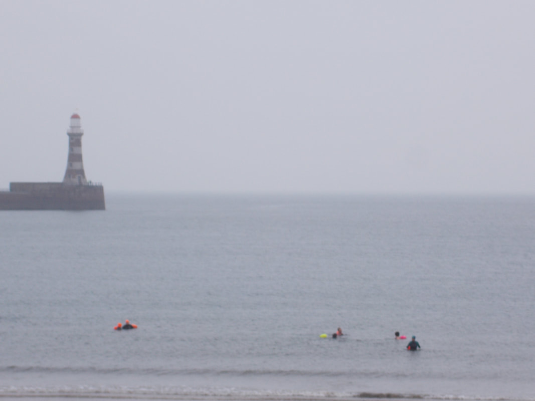
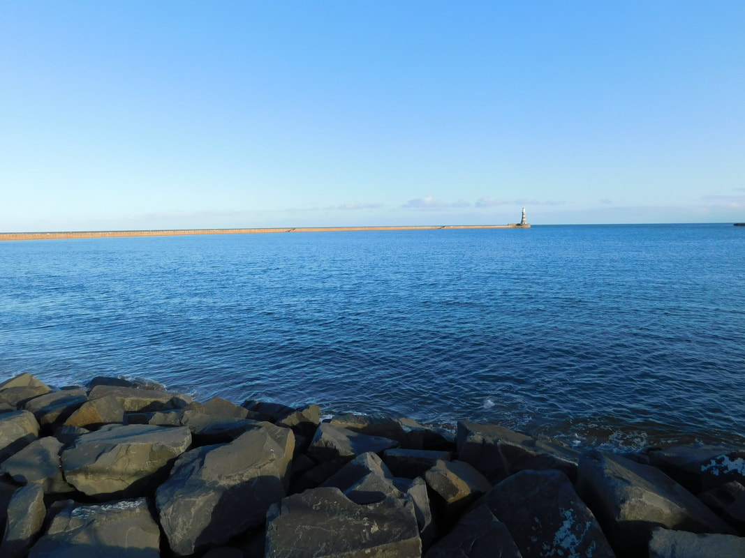
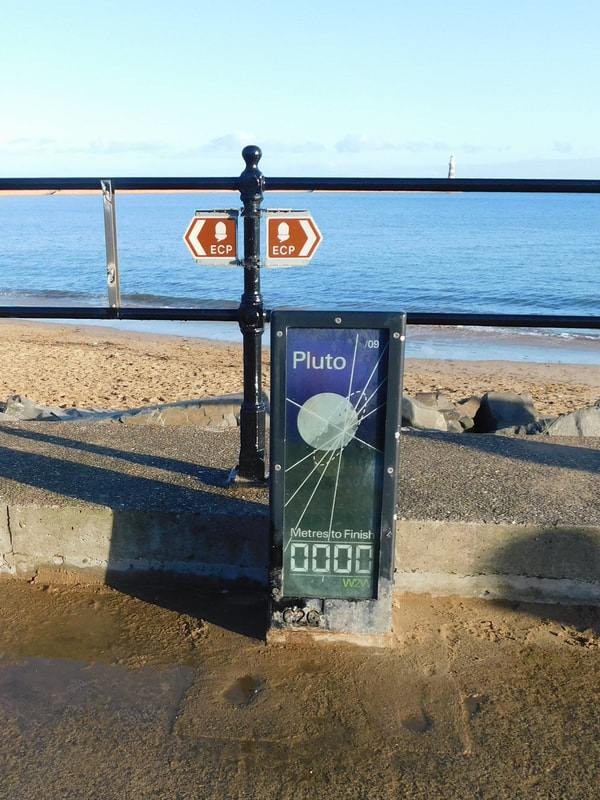
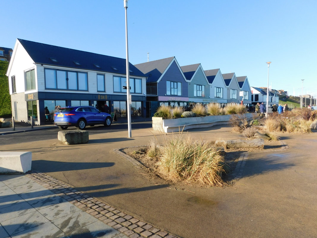
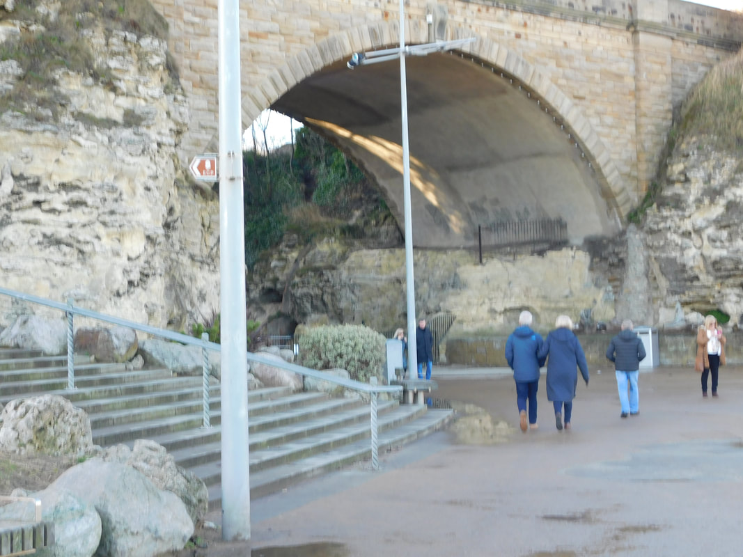
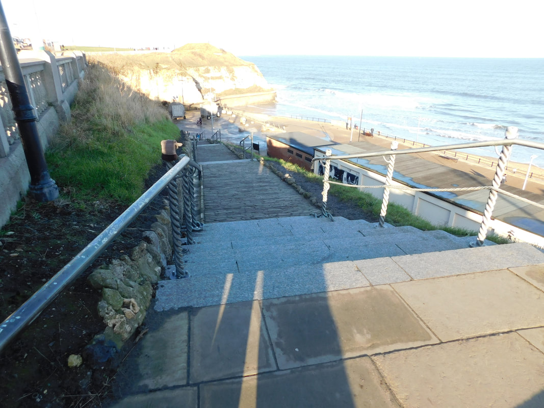
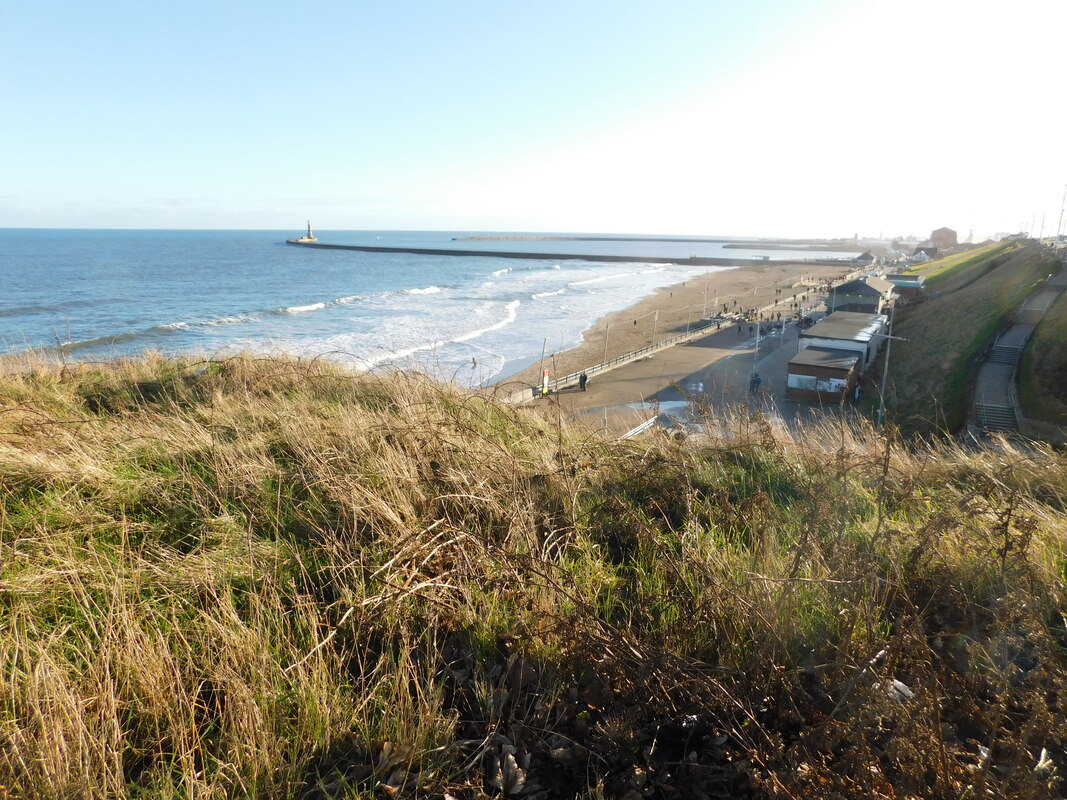
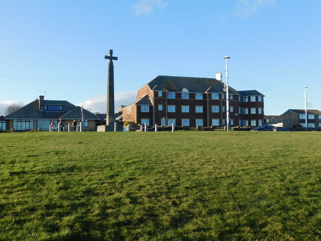
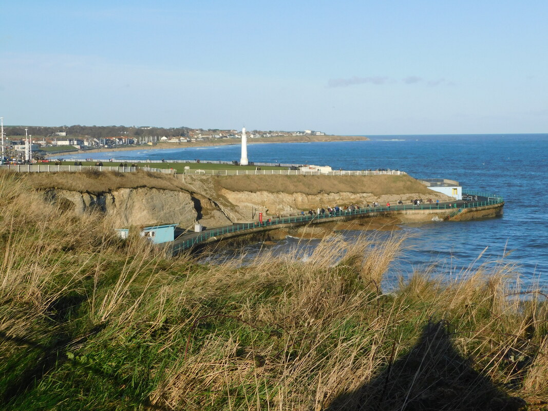
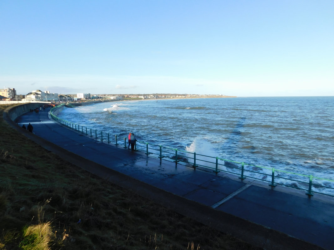
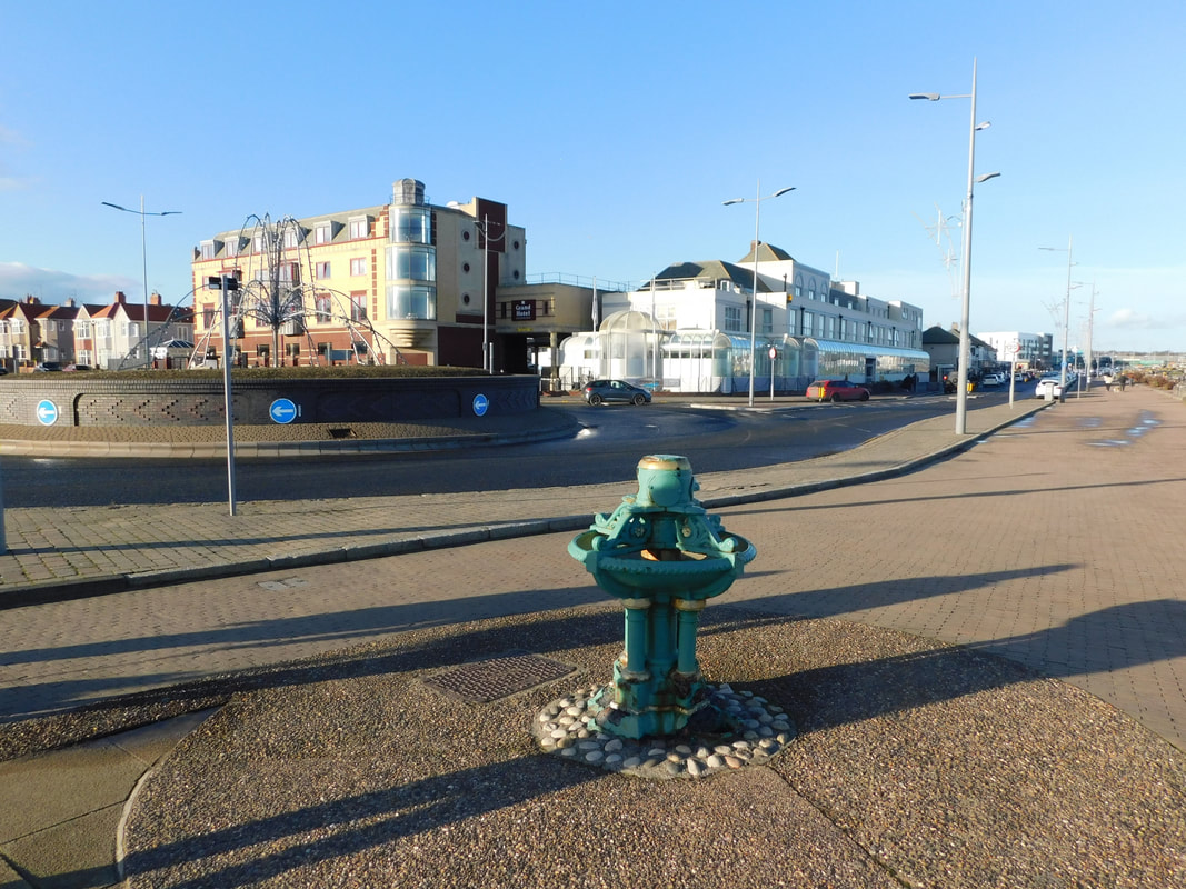
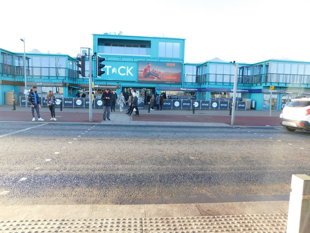
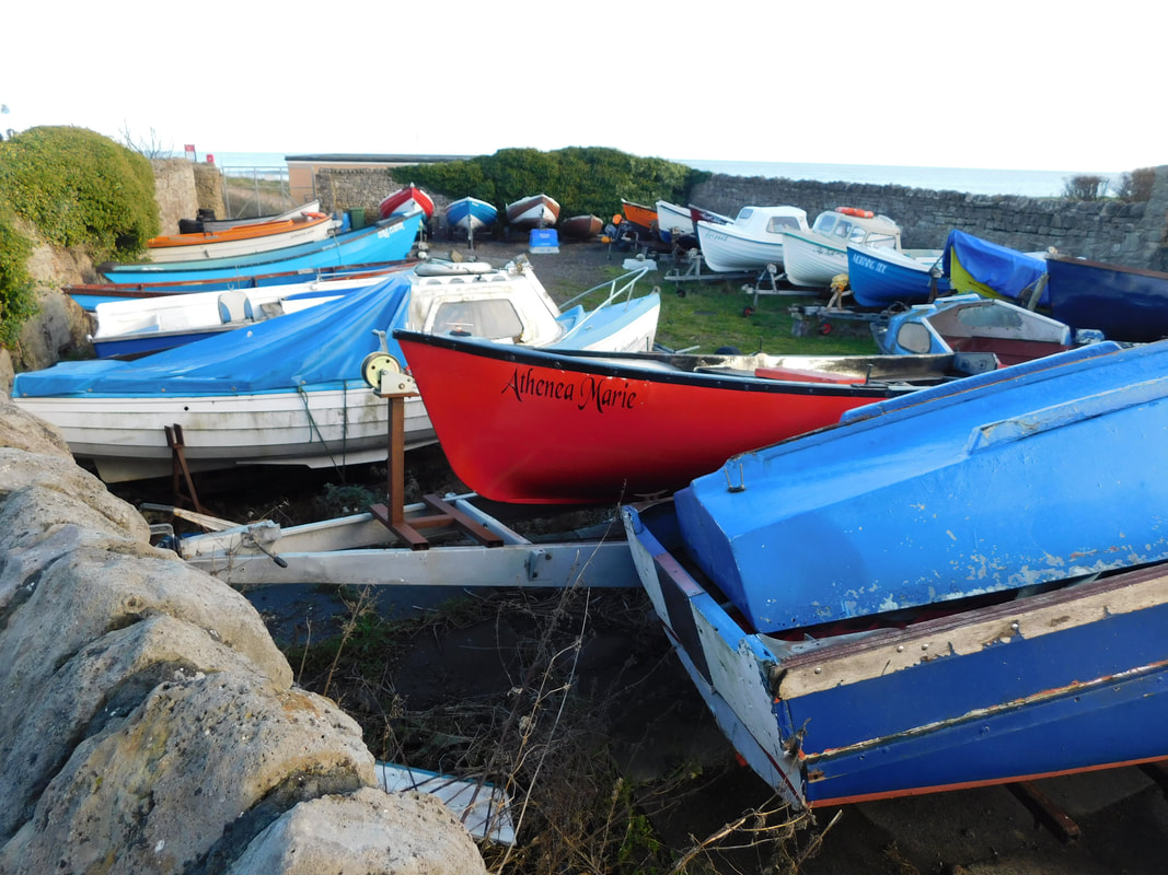
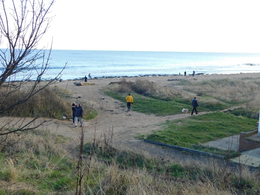
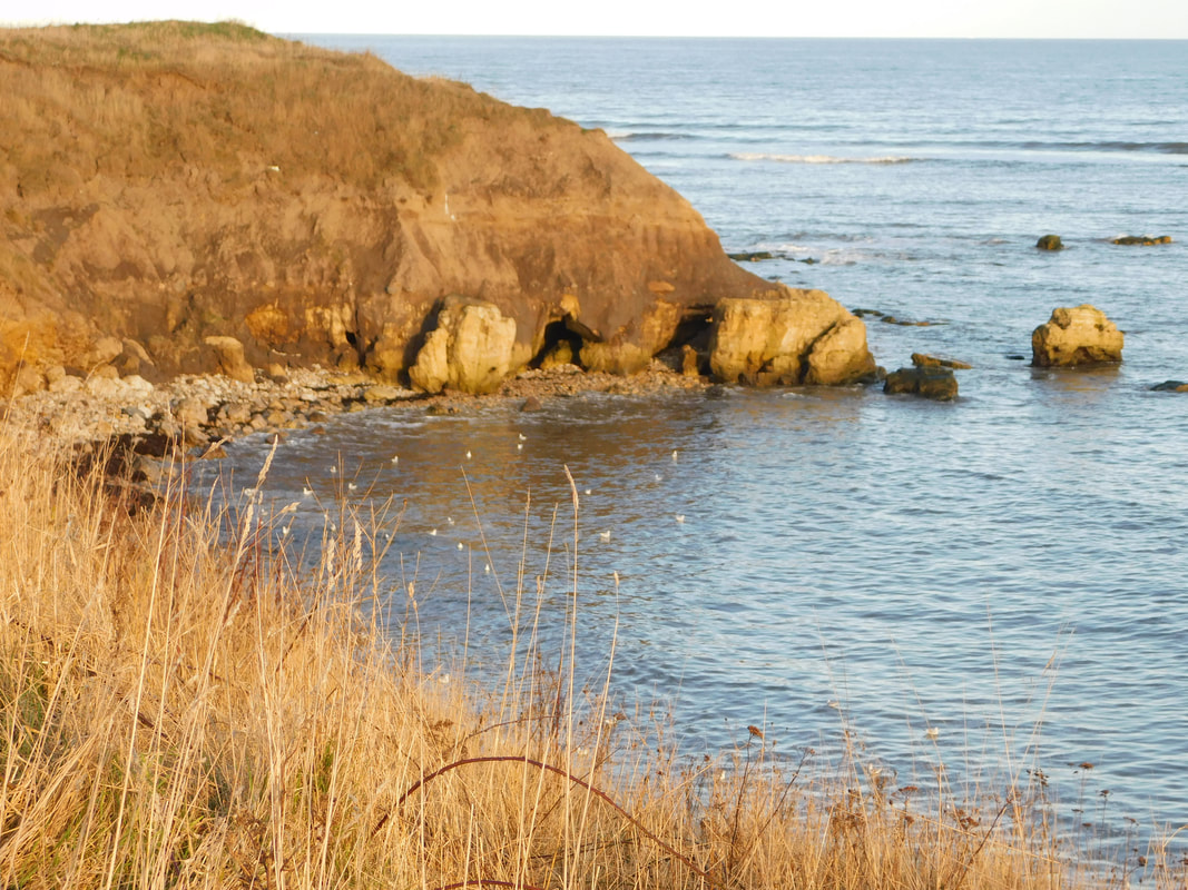
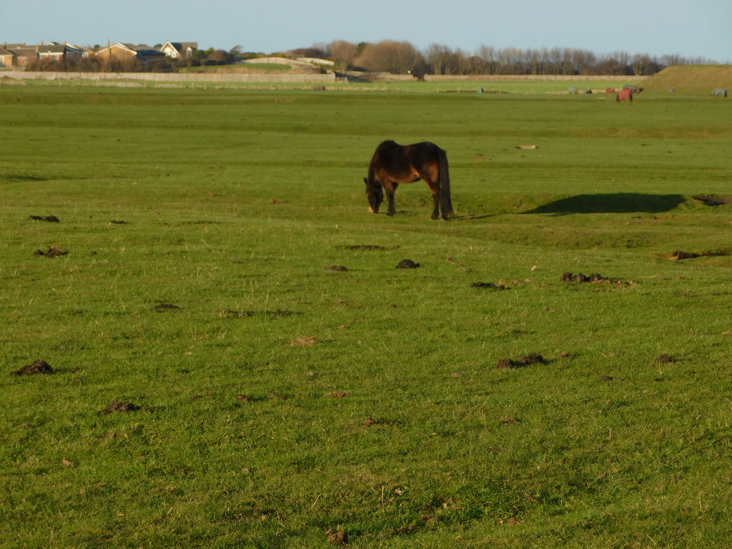
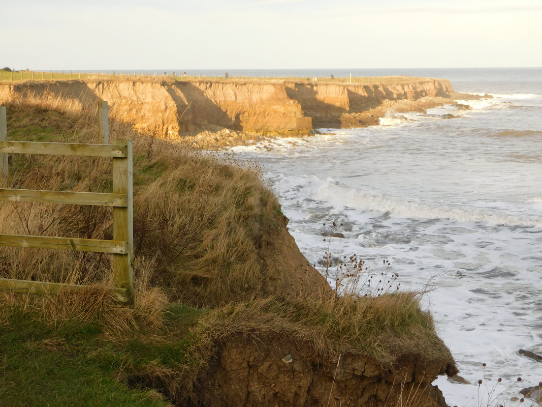
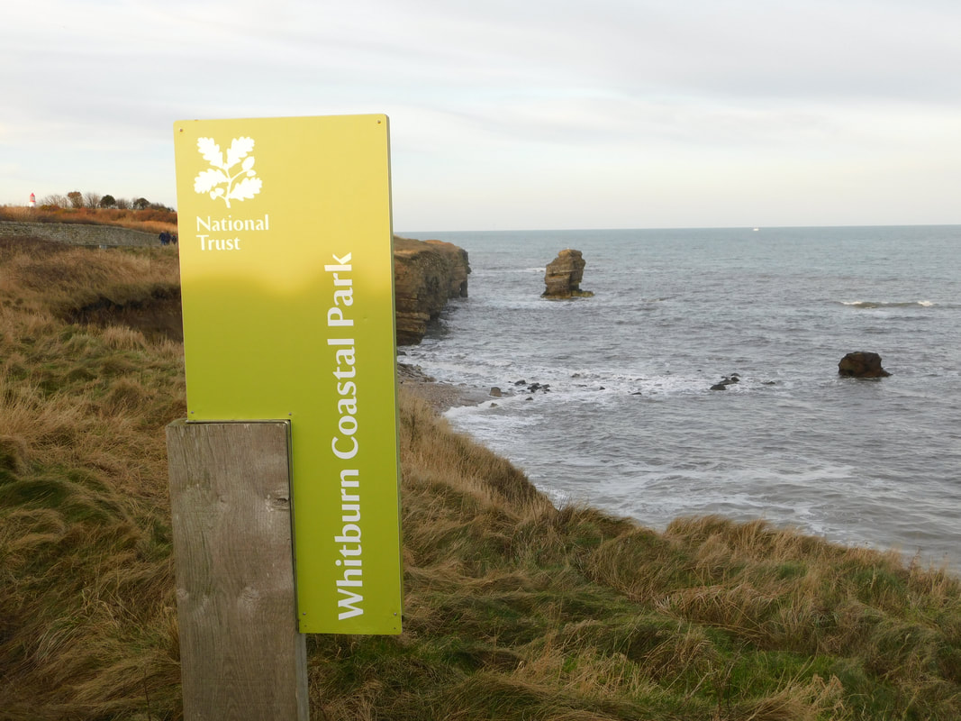
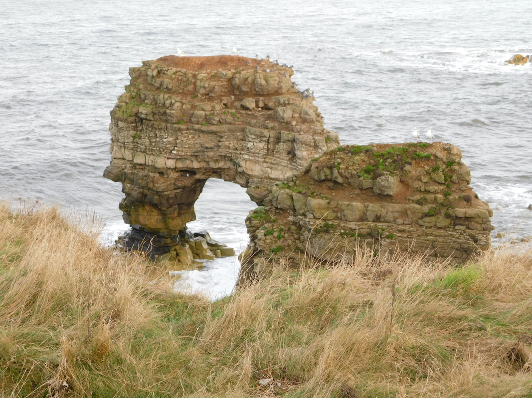
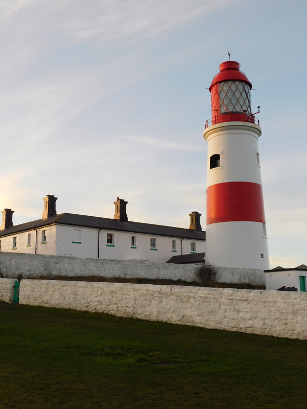
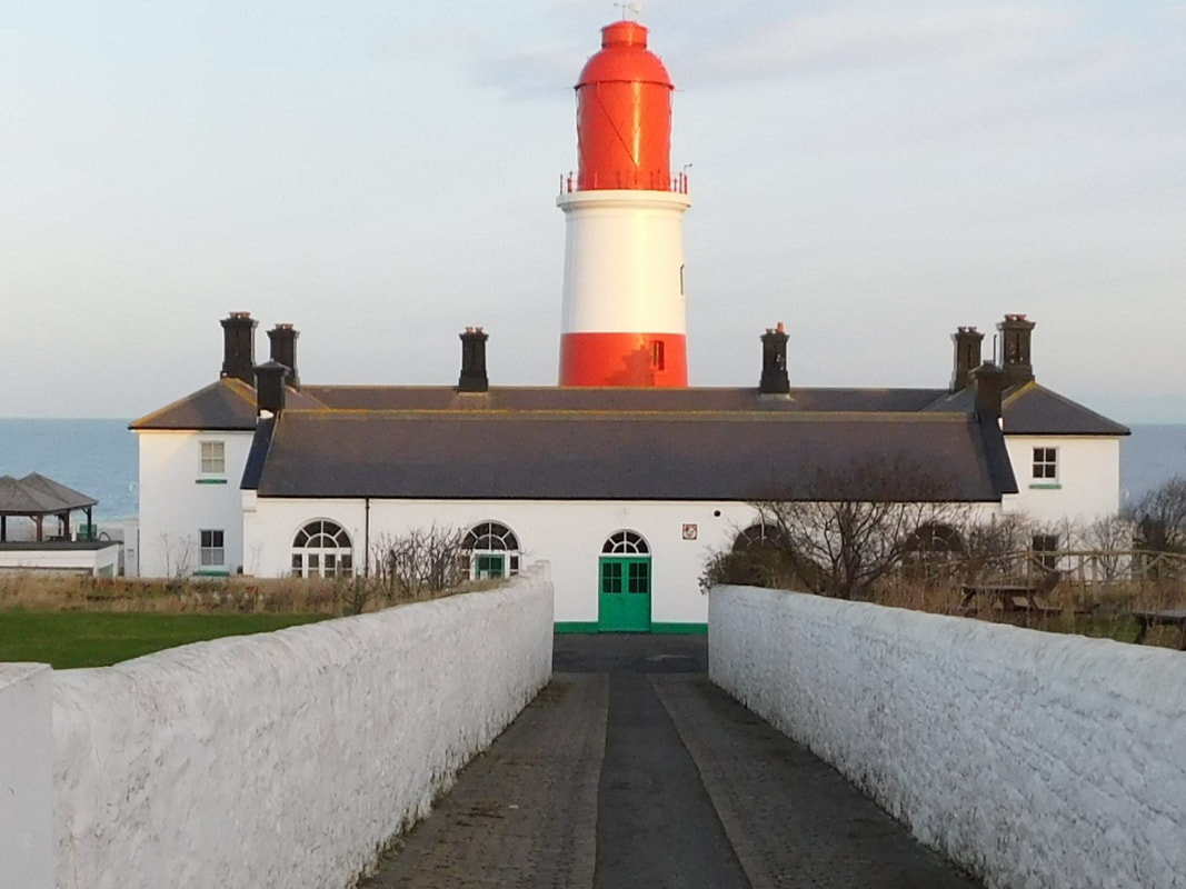
1/20/2022 0 Comments The Challenge Has BegunRoker to Souter Lighthouse Roker We have had some amazing weather lately, those cold but bright clear winter days with blue skies. What else would you do on a sunny day but go to the seaside. So I began my 2022 challenge at Roker, a place I often visit and know well from childhood days at the beach and a place for reflection from my time as a student at Sunderland University. This stretch of coast is still my go-to when I need time to recharge, think and reflect about anything and everything. I hadn't however expected the seafront to be so busy, every man, woman, child and dog seemed to be there. Parking on the lower promenade, I started the walk at the marker for the end of the C2C cycle route which starts in Whitehaven in Cumbria. This part of Sunderland has changed vastly since I was a child, my dad would regularly bring us here whilst he loaded the van with timber from the timber yard where now the new housing and marina are located. After time on the beach we would have to sit on the wood in the back of the van for the ride home. There are very few remnants of the industrial past on this stretch of the Wear today. The smell of fish and chips wafted around the area and althrough there were amazing views of the pier, it was closed today. The tide was also in so many parts of the beach were not accessible because of the waves. The lower promenade at Roker is fairly short and ends at the mouth of the ravine which leads up to Roker Park. The park is well-worth a visit, being opened in 1880, it was one of the main attractions in Roker. It still has a boating lake and bandstand and easy access to the beach. The official England Coast Path (ECP) which on this stretch is marked by the small brown ECP signs, directed me up a flight of steps and across the bridge at the over the ravine. The views back along the promenade to the lighthouse at the end of Roker pier are unobstructed, but following the path around the top of the curved grassed area also provided good views of the White Lighthouse. So far all of the ECP had been paved. I remained on the upper promenade, as those on the lower promenade were getting a little wet. Huge waves were breaking over the sea wall giving much joy to some of the children. Beyond the lighthouse is the Bede Memorial Cross. Here the route overlaps with the Bede's Way Walk from St Paul's church in Jarrow to St Peter's church in Monkwearmouth. Seaburn Beyond this is the old tram shelter which is about to undergo renovations and possibly be transformed into a cafe. This marks the begining of Seaburn. Next to the tram shelter, there are no trams by the way, is the ornate drinking fountain. Opposite the tran shelter, across the roundabout which once had a spectacular fountain in the centre, but alas no longer, these days it has a light display, is the Sunderland Grand Hotel. This was once just known as the Seaburn Hotel. It used to be a little run down inside. My first experience of the Seaburn Hotel, some time around 1984 was at an Elvis Appreciation Event, I went with a friend who was a big fan, and I felt really out of place not having an appropriate costume. Many years later I was working for a local company on a large recruitment project. One night after interviewing all day, we were travelling back to the office when we turned the wrong way up a one way street. This happend a lot back in the 1980s and 1990s, streets would suddenly just become one way in the opposite direction overnight. It took a couple of policemen to sort out the HGVs and buses whose drivers were all as confused as us. Back to the walk, the route continues along Seaburn promenade which is lined with restaurants, cafes and bars including the new Stack. This area has also undergone huge changes since I was young. There used to be a funfair and behind this a zoo which we visited many times as children. This was then replaced with the Seaburn Centre and a Morrisons supermarket. The only reminder this was ever a seaside resort is the amusement arcade next to the supermarket. The one thing that has survived is Minchella's where you can buy fish and chips or ice-cream from the hatch. This place is a good spot to take a breather and refreshments as there are little opportunities for the remainder of the walk. Whitburn Further along the seafront the paved footpath passes in front of some houses and then leads you back to the road, across a small bridge and then sharp right again to follow the road around Whitburn Bents car park. Here the footpath shares the route with the NCN1 cycle path. The ground underfoot becomes a gravel track and follows the cliff tops giving great views of the coastline. Houses and a school line the other side of the path. The cycle path then takes a sharp left up to Whitburn itself, in hindsight I should have followed that route rather than the path. Crossing a large grassed area with rutted tracks, and passing through an A-frame barrier led to a very muddy narrow footpath around the tops of the cliffs. There were warning signs everywhere warning of coastal erosion and encouraging staying back from the cliffs. The A-frame is meant to deter cyclists but many came that way anyway and the path was deeply rutted in places with tyre marks making walking very difficult in places. The path skirts and old rifle range, but these days this is used to graze horses. As the section stretched out with my feet becoming caked in mud, I began to regret my decision to continue. Having mobility issues and not walked for some time I had probably reached the limitations of my physical abilities, however I had reached the point of no return and had about the same distance to Souter Lighthouse as back to the road. I pressed on feeling sore and anxious about the rest of the walk. I stopped and rested for a while and then pressed on. I think not being able to see the end point of the walk and feeling it should have been closer than it was caused some phsychological problems, but I reconciled this with the notion this walk was to test my abilities to help in planning other walks. I kept looking at the stunning coastal scenery and telling myself this was why I was walking the coastal path.
Practicalities
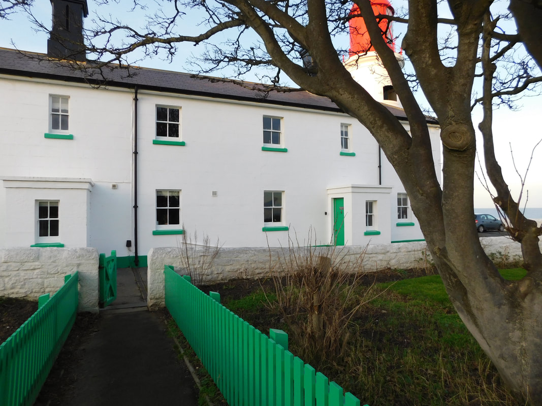
I parked in the Harbour View car park on the seafront at Roker, this cost £3.00 all day. There are toilets along the promenade at Roker and Seaburn and cafes, restaurants and bars here too. There is little else from Whitburn to Souter Lighthouse which is approximately half the walk but took much longer than the first half because of the muddy footpath, narrow part of the path where you may need to give way to other walkers and cyclists. There are also toilets and a cafe at Souter Lighthouse when open. I took the E1 bus from outside Souter Lighthouse back to the car park. This bus runs along the seafront from South Shields to Sunderland City Centre, costing £2.80 one way. 12/15/2021 0 Comments England Coast PathI am excited to be planning some short walks along the North East section of the England Coast Path (ECP) for the new year, but it hasn't been easy. There is not yet a definitive map that I have been able to find and the websites below do not yet cover the relevant sections in depth. This website should hopefully plug the gap in the meantime and help you on your journey to the North East section of the ECP.
If you would like to walk any part of the ECP you might find the following websites useful.
I did buy the one 'guide book' available, The England Coast Path: 1000 mini adventures around the world's longest coastal path' by Stephen Neale. There are many beautiful pictures in the book, however it is not a guide, there are no descriptions of the path sections and no maps. It is also too heavy for a backpack so only consider buying this if you want some visual inspiration. |
AuthorWrite something about yourself. No need to be fancy, just an overview. CategoriesAll England Coast Path North Gare To South Bents South Bents To Amble
|

 RSS Feed
